Ventura County Landmark No. 28: Mission Aqueduct
Historical Background
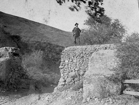
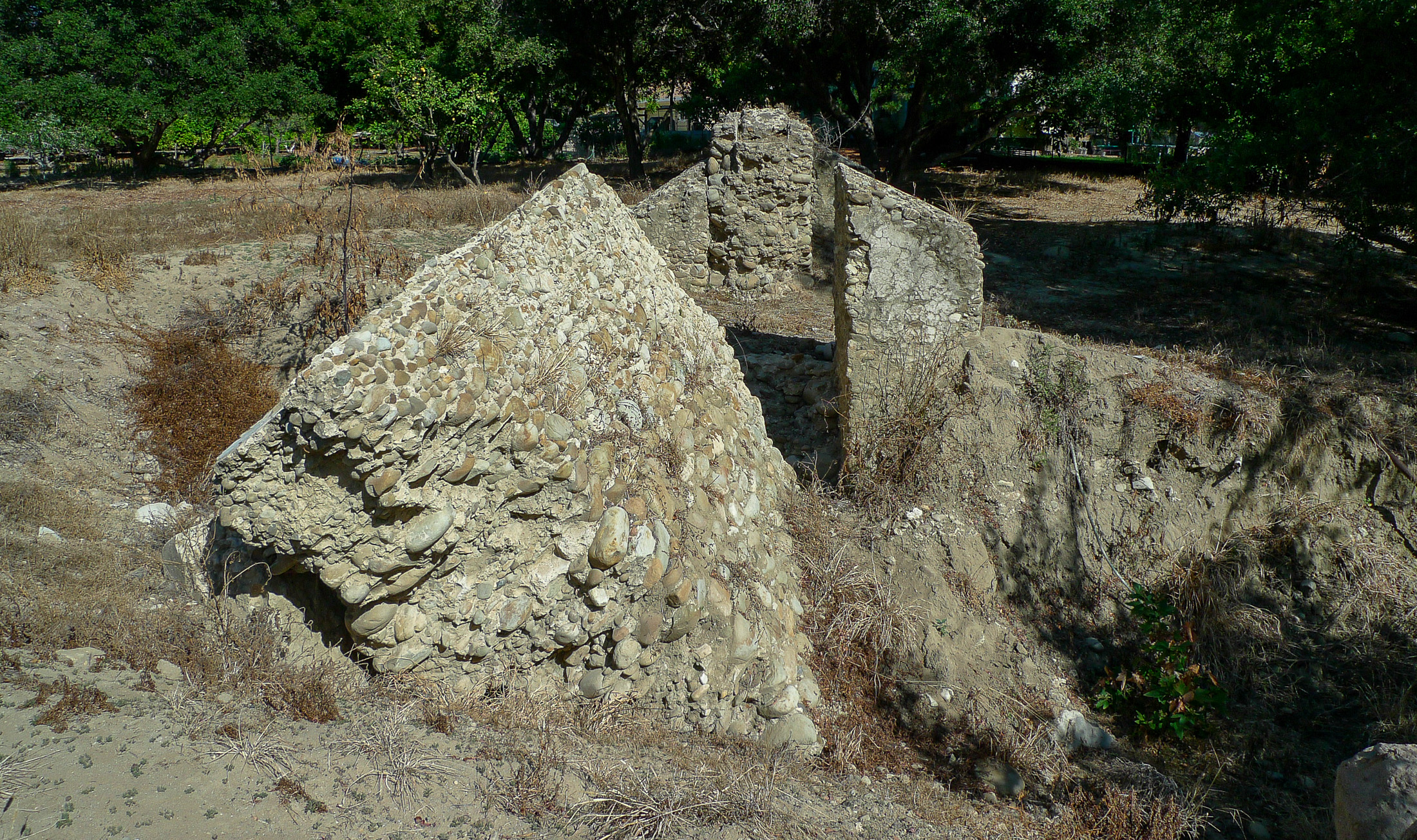
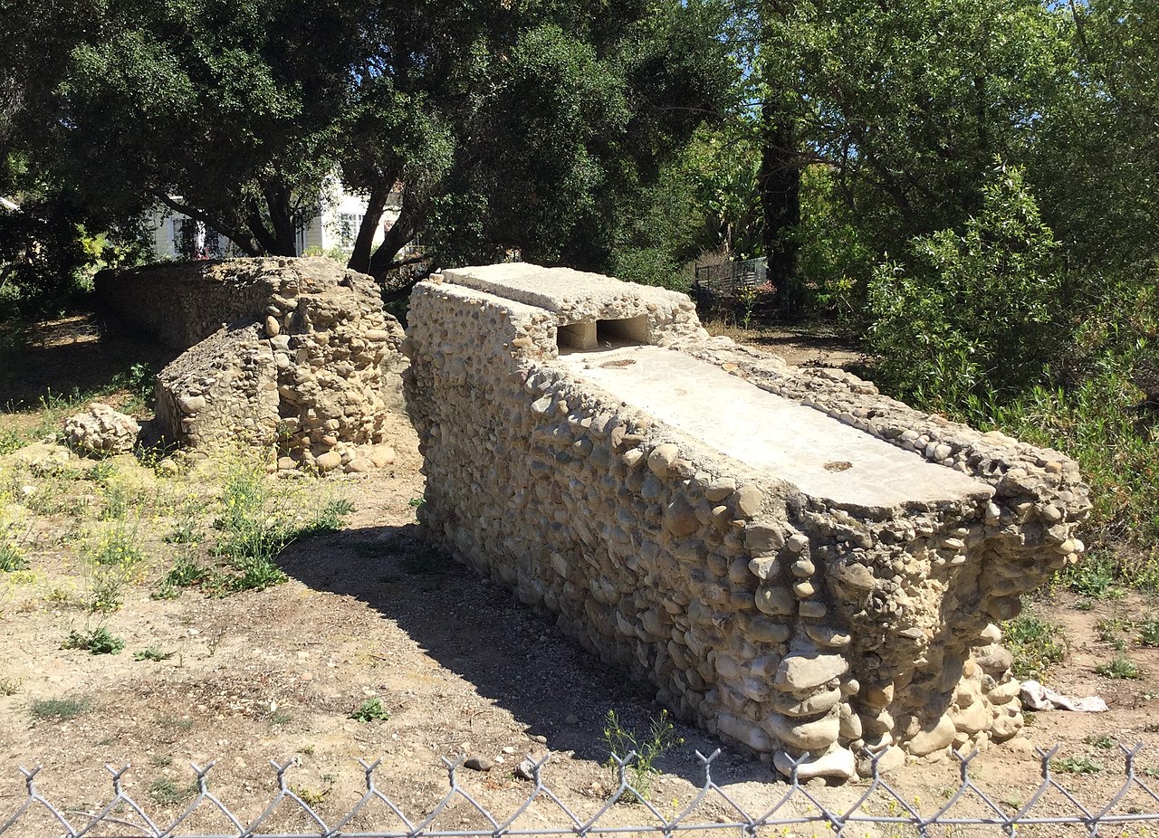
This landmark is a 100-foot remnant of an elaborate seven-mile aqueduct built by Chumash Native Americans at the direction of Mission San Buenaventura priests to bring river water to the mission. Accounts vary greatly as to when the aqueduct was built; the historic data surrounding the development of Mission San Buenaventura point to an aqueduct construction date within the years 1805 and 1815. The aqueduct served the mission’s vineyard, orchards, gardens, and lavanderia until it was damaged by floods in 1862. Over the years, weather and development have destroyed most of what remained. The primary remaining segment of the aqueduct sits near Cañada Larga Road and is about one hundred feet long, seven feet high, and five to ten feet wide, including the supporting buttresses. The aqueduct, and its attendant settling tank built at the same time at Valdez Alley near the present mission, are said to be among the oldest standing man-made structures in Ventura County. The remaining aqueduct at Canada Larga survives as a small but significant portion of the extensive San Buenaventura Mission Water System.
The San Buenaventura Mission aqueduct at Canada Larga Road is a significant structure in both Ventura County and Western American history. The Mission aqueduct is one of the County’s oldest and most valuable Landmarks (No. 28), a State Landmark, and a National Register site, and one of the few recognized by all three government levels.
Chumash and Mission History
The Chumash historically occupied the area between the southerly end of Monterey County and Malibu (Post/Hazeltine Associates, 2021). The Ventureno Chumash were a semi-sedentary society with a stratified social order, extensive trade networks, and a maritime adaptation characterized by wood plank canoes and trade with neighboring groups, including those on the Channel Islands. In 1782, Mission San Buenaventura was established by the Spanish government in what is now downtown Ventura. The mission system was intended to Christianize the Chumash and transform them into agriculturists and subjects of the Spanish Empire (Post/Hazeltine Associates, 2021).
Mexican artisans (stonecutters and stonemasons) forever changed the appearance of California’s missions. These workers were brought in by the Spanish government from 1770 until 1800 to serve as both laborers and instructors to the Native Americans in masonry construction, which flourished throughout the California mission system. The dexterity and agility of the Chumash Native Americans, combined with the skills learned from the Mexican and Spanish artisans, created the elaborate seven-mile aqueduct running along the Ventura foothills. Without a permanent water supply, the San Buenaventura Mission community could not have survived.
The remaining aqueduct represents an impressive technical accomplishment of the early California water system. The aqueduct served the mission and community from the time of construction until the system was destroyed by the floods of 1862. There is little doubt that this aqueduct ruin constitutes one of the oldest man-made structures in Ventura County, and the local landmark is a prime example of the various cultural influences that built the state of California.
Construction
The composition and style of the aqueduct at Canada Larga, like other raised mission aqueducts, reflects missionary interest in traditional architecture. It, like the mission, testifies to the influences of Marcus Vitruvius Pollio (First Century B.C. Roman architect and engineer), and the importance of classical architecture in the world of Spanish California.
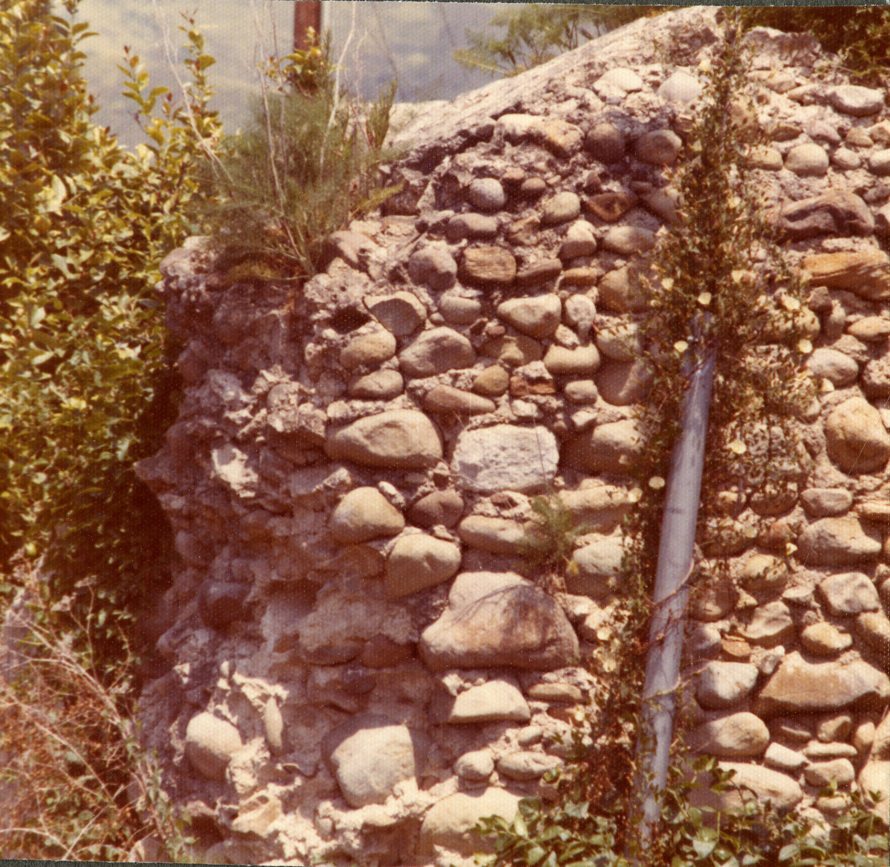
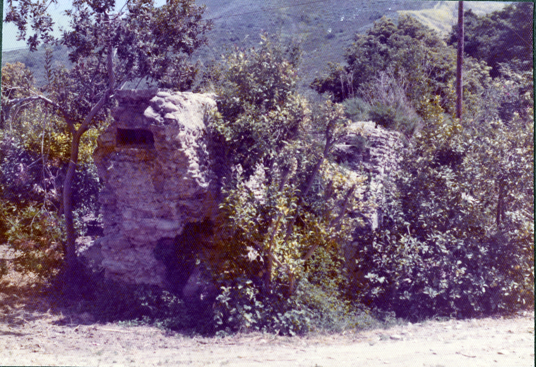
The aqueduct is made of cobble stone and mortar (random rubble). The walls are supported on both sides by two massive buttresses that are six feet wide and range in thickness from 4-1/2 to almost 7 feet. The remaining structure consists of two masonry supports, which total an approximate length of 100 feet. A 12-foot gap between fragments resulted from a turn-of-the-century blast to create an opening for a road. The height of the aqueduct ranges from 10 feet at the northwest end to under 2 feet at the southeast corner.
At Canada Larga, the aqueduct was a covered system. The channel at the top of the structure is approximately 10 inches deep and 30 inches wide. At other sections along the foot of the hill, there are several remaining portions of the acequia (Spanish for irrigation ditch) masonry still intact. There are other segments of the aqueduct that are underground further to the south toward the mission. Time and the elements have destroyed much of this structure. Nevertheless, much of the destruction has been accomplished by development of the area during the last century.
Some undisturbed sections of the Mission aqueduct are covered at present by a thin layer of soil. There are other small acequia sections found to the north where the aqueduct had been built along the steep slope of the hill. The downhill side of the trough has broken away from the main body. In some places that have fallen down, the uphill side remains. In some areas, the broken sections have not been found. The acequia sections were merely open lined ditches of unmortared stone, brick, or mortared stone of brick. One acequia was discovered by Gessler in 1968 within the compact soil of the hill, around which the water flowed to the aqueduct at the Canada Larga. The small sections that were found are owned by several private citizens and the City of Ventura.
Current Site
The Canada Larga portion of the San Buenaventura Mission aqueduct rests on an acre site adjacent to Canada Larga Road, four miles from the mission and downtown Ventura. The County-owned property is situated approximately east of Highway 33 and is bordered on the west by a stream. The aqueduct bridges this wide stream, some 150-200 feet. The channel originated from a dam, probably between 1-2 miles north at the junction of San Antonio Creek and the Ventura River. The creek is less turbulent and still exhibits a natural dike near the junction of the two flows. (Robert Browne, San Buenaventura Water System, 1974)
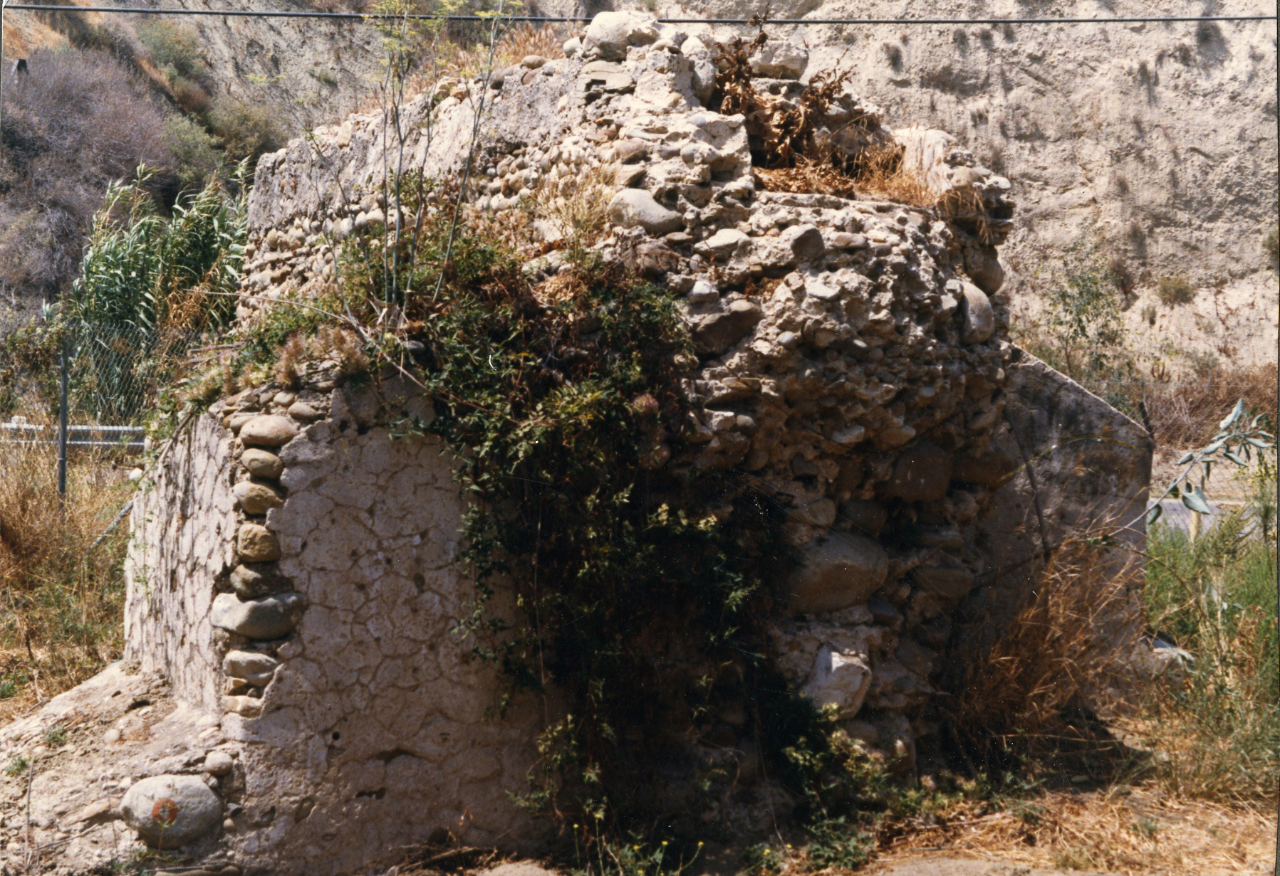
The El Nino and 2005 rain storms eroded the site, bringing the nearby creek closer, destroying the protective fence, and tipping the front segment of the aqueduct on its side. Following this, the ruins were comprehensively stabilized in order to prevent further deterioration and damage to the masonry (ARG Conservation Services, Inc., 2021). This was successfully achieved by up-righting the overturned sections of masonry wall to their original positions to minimize the direct exposure of lime mortar and cobble stone to the elements as well as by grouting and re-pointing the masonry. Re-grading and installation of boulder rip rap also repaired previous flooding damage and will protect the site from future flooding (ARG Conservation Services, Inc., 2021). The stabilization and repair of this section of aqueduct at this remote site not only allows visitors to understand how the aqueduct was constructed and originally functioned, but preserves a small portion of the remains of a significant piece of Californian history (ARG Conservation Services, Inc., 2021).
The Ventura County Parks Department owns the site and maintains it with a protective fence, weeding, security, and grading. The Mission aqueduct remains in need of long-term weather protection.
Additional Reading
References
ARG Conservation Services, Inc. (2021). San Buenaventura Mission Aqueduct. https://www.argcs.com/portfolio-item/san-buenaventura-mission-aqueduct/.
Post/Hazeltine Associates (September 3, 2021). Historic Resources Report, 76 Oak Drive, Ojai Valley, Ventura County, California.
Image Copyright Notice
Side Photo (Bottom) – CC BY-SA 4.0.
Date Designated: January 1976
Location: Cañada Larga Road (south side), 1/4 block east of Highway 33, Ventura
Photos: